Mt. Whitney Trail

What to say about Mt. Whitney? If you had told me a year ago that I might be climbing mountains for fun, I would have had a tough time taking you seriously, if only because I had no idea how to even envision what 'hiking a mountain' entails. And yet, here I am, having climbed the tallest peak in the lower 48 states and hungry for more. Life is funny.

Sunday, July 10th
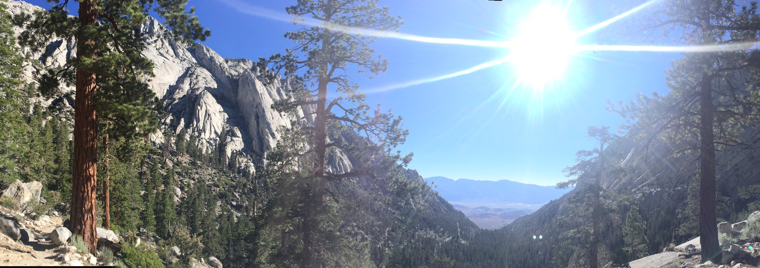
We woke up at Whitney Portal Campground at 7am, tucking in the night before around 7:45pm. After cleaning up our campsite and clearing out the bear lockers, we drove over to the trailhead and proceeded to re-fill the new bear locker with everything scented that wasn't coming on the trail with us. By 7:56am, we were on the trail with the sun brightly shining. Our packs weighed in between 40 and 41 lbs, due to an obscene amount of food that we would later realize we would never be able to consume (or securely pack into the bear canister overnight).


At 10:24am, we made it to Outpost Camp (3.8 miles, 10,360') and then to Trail Camp (6.3 miles, 12,039') at 1:27pm. We had expected to get to Trail Camp much later in the day (around 5pm), so with all the extra hours at our disposal, we took our time setting up camp, filtering and refilling our water supplies, and preparing out summit packs so that we could leave behind the heavy bear canister and tent to summit. In order to actually fit all of our food and scented items in the bear canister overnight, we ended up giving away a fair amount of our food to some fellow campers. Thankfully, they were worried about not having enough food and we were happy to bid adieu to some of our unnecessary weight.


We played some cards and settled into our sleeping bags at the ridiculously early hour of 7:45pm. Because Trail Camp lies to the east of the Whitney ridgeline (and in the shadows of the infamous 99 switchbacks), as soon as the sun dipped behind the mountain's silhouette, a chill took to the air. The night before had seen wind gusts up to 50mph and almost every hiker we passed on their way down had called it one of the worst nights of their life. Consequently, I took no chances at losing any of my body heat and was perfectly happy snuggling into a sleeping bag cocoon while daylight lingered. And it paid off – though we luckily had an almost windless night – I was warm and cozy every time I woke up throughout the night.


Monday, July 11th
The next morning, we were up at 3am and on the trail at 4am. The absolute best part about making it a 2 day trek and staying overnight at Trail Camp is that it allowed us to trudge up the 99 switchbacks in the dark. With just the light from our headlamps and the rising sun in the east, it was easy to focus simply on the steps at hand, rather than feeling demoralized by how endless the switchbacks can seem. We easily made it up to Trail Crest (8.5 miles, 13,600') at 6am and crossed over to the west side of the ridgeline, leaving the beautiful morning sun behind. The worst part of summiting, aside from the chill in the air that hadn't yet felt the sun, was going downhill to the junction with the John Muir Trail. After working so hard to gain that elevation (and stave off any altitude sickness), it was a bummer to descend (and even more annoying to have to ascend on the way down from the summit).


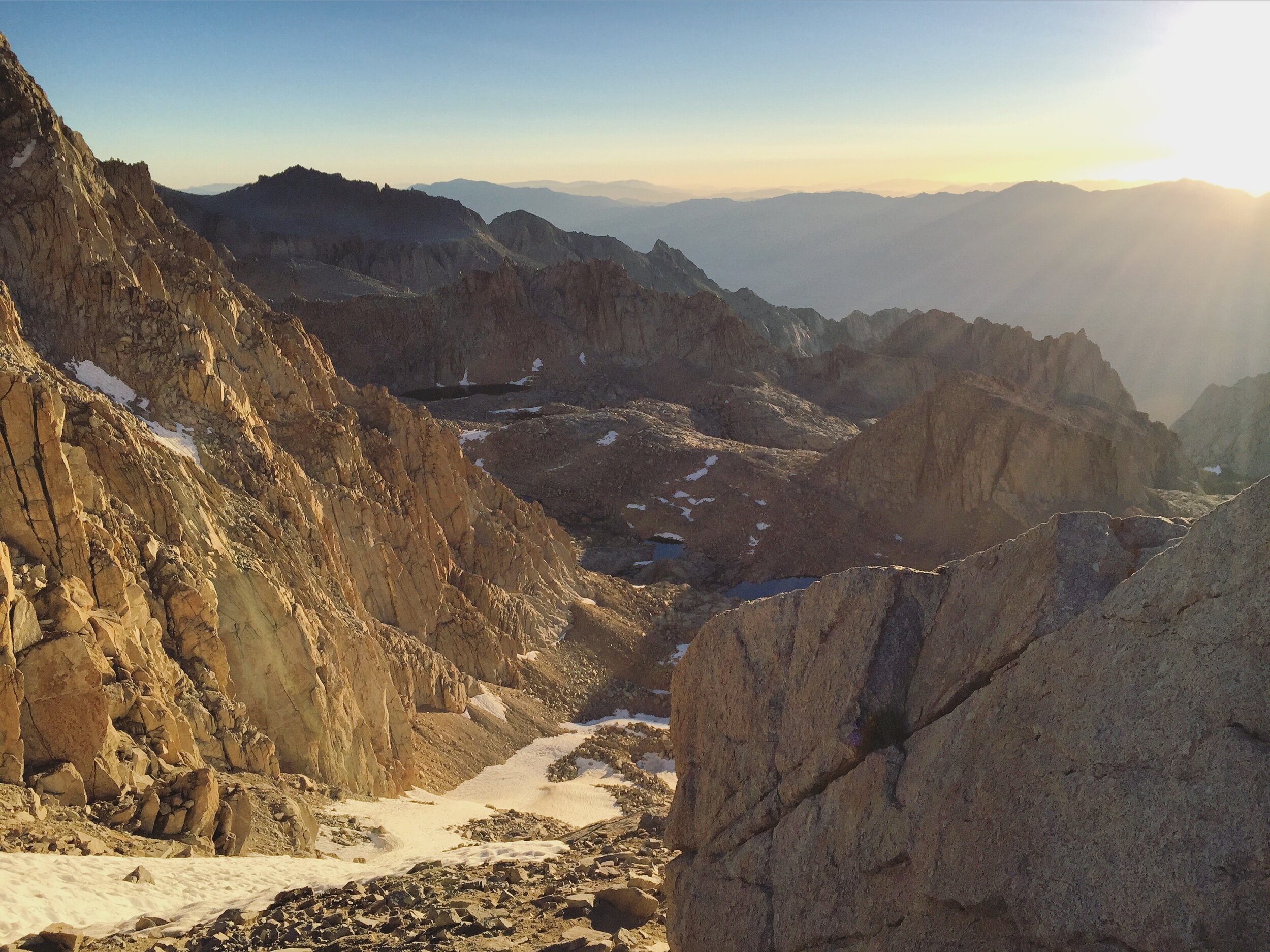

Regardless, we persevered on: by the windows, through a tightly compacted snow bank, and many, many boulders. At this part, it became clear that Erin was handling the elevation far better and she hiked ahead and summited around 7:40; I made it to the top around 8am.


14, 508'! The highest place in the contiguous 48 states. We took in the views, chatted with a handful of other summiters, called our parents, signed the summit log, and then begin our descent at 8:25am.


We were back at Trail Camp at 10:46am; after filtering a bit more water and packing up our camp, we hit the trail for the second time that day at 11:43am, this time weighed down by our full packs. We were at Outpost Camp at 1:02pm and back at the trailhead at 2:33pm. With all our extra time, we ended up driving back to the city (the lure of sleeping in our own beds and taking a shower were too strong to ignore). And so, I was awake for 25+ hours, climbed a freaking mountain, and still woke up at 6:30am the next morning, wide awake and ready to attack the day. Insomnia is weird. All in all, we traveled 22 miles and gained 6,100 feet in elevation in 16 hours. The unexpected speed with which we completed the hike gives me an itch to try it again as a 1 day hike.

Read more about how we acclimated: Friday, July 8th and Saturday, July 9th: Robinson Lake Trail
More photos here. And my novice attempt at a packing list here.
Food brought (*and given away):
miso hummus and carrot sticks*
falafel*
lavash*
bulgur salad
farro and barley salad with kale pesto, chickpeas, roasted sweet potatoes and mushrooms
banana bread with individual packets of almond butter
trail mix
1 package of dried figs
flavored dried seaweed snacks